
Greensboro Neighbors by Block Source
Different records answer different block questions. Guilford’s map and property-card tools are the starting point for parcel boundaries, ownership, legal descriptions, and mail contact. The state voter search is a searched-person tool, not a street browser. City neighborhood plans identify planning areas, while historical directories may preserve occupants from an earlier date. Treat owner, resident, voter, and community member as separate categories unless a source expressly connects them.
| Source | What It Shows About a Block | Access |
|---|---|---|
| Guilford GIS and Area Plan Viewer | Parcel geography, surrounding polygons, streets, city, landmark, zoning, watershed, and planning layers | Free online map; live click controls vary |
| Guilford NCPTS | Owner/entity, situs and mailing addresses, REID/PIN, deed reference, acreage and land class | Free county property-card portal |
| NC voter search/file | Status and civic details for a searched voter, with protected fields withheld | Free state access subject to law |
| Election district map | Precinct, polling place, districts, and precinct percentage data | Free map, not a person roll |
| Neighborhood plans and older directories | Named planning areas or dated published occupants and businesses | City planning routes and local collections |
Parcel ownership is not occupancy. A mailing address can belong to a trust, business, family member, or owner who lives elsewhere. Renters, children, unregistered people, protected voters, and other household members may not appear in any of these sources. That limitation is the reason to use the map and property card as a parcel overview rather than a roster of Greensboro neighbors.
Trace Greensboro Neighbor Parcels
Start with the address’s REID or PIN when it is available. Guilford’s Primary Data Viewer is the county’s map route, and the Area Plan Viewer is the documented text-visible alternative. The Area Plan Viewer accepts an address or REID and can show parcel information, owner name, address, legal description, and planning layers such as streets, zoning, watershed, landmarks, cities, water/sewer boundaries, scenic corridors, creeks, and planning areas. The research did not verify a fixed buffer or radius control in the live viewer, so do not assume one exists.
The parcel-to-block sequence is deliberately narrow:
- Find the known address in NCPTS or the Area Plan Viewer and save the REID or PIN, situs address, legal description, and map position.
- Turn on relevant parcel, street, city, landmark, zoning, or watershed layers, then identify only the adjoining or nearby parcel polygons needed for the question.
- Open each adjacent parcel’s NCPTS card and note the public owner/entity, mailing and situs addresses, acreage, land class, deed book/page/date, and map relation.
- Compare legal descriptions, plats, or deed references when parcel edges or older tract names make an address match uncertain.
For a full street-by-street record chain, use the Greensboro street address directory. A block review should stop at the surrounding parcels instead of expanding into a street-wide collection of people.
If a boundary is unclear, do not force the match from a street number alone. The parcel card’s legal description, acreage, plat reference, and deed book/page offer a way to compare the land itself. A subdivision lot or an older metes-and-bounds description can survive even when a house number, road name, or parcel shape has changed. The Register of Deeds index is the next source for a deed reference, but an index entry remains a reference point rather than a certified ownership conclusion.
Greensboro Neighbors Need Address Context
The detailed NCPTS card can show owner, mailing address, situs address, legal description, deed book/page/date, sales, values, buildings, tax fields, and a map route. Its mailing and situs entries should never be merged into one claim. The situs tells where the parcel is. The mailing address tells where the tax system sends correspondence. Research on an inspected Greensboro parcel found a local situs with a Durham mailing address, a useful reminder that an owner result does not prove a household match.
Insider tip. Record the REID/PIN and legal description with any name. Street numbers can change, parcels can split or merge, and an owner may hold more than one nearby tract. The parcel identifiers make a later correction far easier to trace.
The county’s Parcel Research application is a separate query route. It can search fields such as property owner, ZIP, zoning, ETJ, and assessed values, displays up to 150 records, and exports the result set to CSV. That is useful for property geography, but it is still a county tax-data tool. Daily updates and the county disclaimer mean a saved date matters.
Greensboro Neighbor Election Geography
Guilford’s election lookup is useful for locating a block within a precinct, polling place, municipality, county commissioner district, school-board district, Superior Court district, NC House, NC Senate, and congressional district. It can also provide precinct party percentages and demographics. The district map is not a person roll. It cannot identify every resident on a block, and precinct percentages do not identify the views or registration of an individual household.
The image below comes from the official Guilford election district lookup in the image manifest. It is the right tool for the map question, not a substitute for a searched voter result.
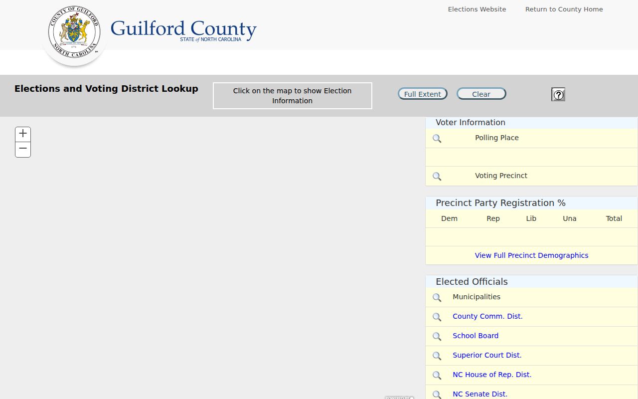
NC Voter Search instead requires a person’s first and last name, with optional middle initial, birth year, and county filters plus a selected status category. Public voter information has legal limits, and protected addresses, full birth dates, driver-license information, Social Security data, and other protected details are withheld. Use election geography to understand the block’s public districts, then use a lawful searched-person record only when a specific identity question remains.
Greensboro Neighbor Contact Routes
Community routes give a block social context without claiming a household directory. Greensboro’s Neighborhood Plans inventory names the Cedar Street area, Historic Dunleath, College Hill, Glenwood, Jonesboro/Scott Park, Lindley Park, and Heath communities. The city GIS neighborhood polygon layer uses approximate natural and man-made boundaries. Those labels are helpful for finding a plan or public meeting contact, but they are not legal parcel boundaries and can overlap or be approximate.
| Organization or Area | Publicly Supported Route | Directory Boundary |
|---|---|---|
| Greensboro Unified Neighborhood Association | Current umbrella and community contact route | No complete public member roster was located |
| Cedar Street, Historic Dunleath, College Hill, Glenwood, Jonesboro/Scott Park, Lindley Park, Heath | City Neighborhood Plans maps and planning material | Plan-area names do not establish household membership |
| College Hill | Community contacts and events are described in local material | No verified complete current membership directory located |
| Former Greensboro Neighborhood Congress | Historical alliance reference only | Its own route points to a 2023 dissolution notice; do not treat it as current |
Ask a community group directly for its public contact or meeting information rather than assuming a membership list. Congregations, clubs, schools, and civic groups can hold private information. The research found no complete official Greensboro association directory, so no unverified association directory is presented here.
The current route deserves a freshness check. Material about the former Greensboro Neighborhood Congress may still describe a wide alliance, but its own route points to a February 2023 dissolution notice. Greensboro Unified Neighborhood Association and the city’s Neighborhood Plans are the supported current starting points. A Chamber member directory is also not a household directory. It searches organizations by category, subcategory, ZIP, or name and describes business or civic affiliation rather than residence on a block.
Greensboro Neighbor Record Choices
Official sources and commercial compiled-data tools serve different purposes. The first group identifies the custodian and the limits of a particular record. The second group may combine public filings, marketing sources, directories, and other data, but its date, coverage, and source attribution can vary. Neither category overcomes protected voter, utility, DMV, or household privacy rules.
| Source Category | Best Use | Important Limit |
|---|---|---|
| Official county parcel and deed records | Verify a parcel, owner/entity, legal description, or recorded transaction reference | Owner and tax-mail fields do not prove occupancy |
| Official election and planning maps | Verify precinct, district, polling-place, or named-area geography | They are not lists of people on a block |
| Library and historical directory collections | Check an address or person in a stated historical year | Coverage and household detail differ by edition |
| Commercial compiled-data category | Generate a lead to verify with a custodian | May be stale, incomplete, mismatched, or lack clear source dates |
Use a source only for the field it actually supplies. A county card can be checked against the Register of Deeds when a recorded transfer matters. A planning polygon can explain the named area without deciding a parcel boundary. A historical directory can place a person or business at an address in its printed year, but it cannot establish who is there now. Keeping those roles separate prevents a convenient search result from becoming a claim the source never made.
Privacy Limits for Greensboro Neighbors
North Carolina public records are open subject to record-specific laws, including N.C.G.S. Chapter 132. That does not make every address or person detail available. The Address Confidentiality Program gives eligible survivors a substitute address, voter rules protect qualifying addresses, and state law withholds sensitive identifiers. Utility customer records, DMV address data, juvenile records, sealed or expunged cases, and protected proceedings have their own restrictions. School-zone tools map a location to a school, not children or households.
When a public record is wrong, contact the office that holds it. A Register of Deeds indexing correction does not change an original recorded instrument, and a voter-protection request belongs with election officials. N.C.G.S. §132-1.10 permits written requests to remove or redact listed sensitive identifiers from public records when the statute applies. Do not send a driver license, Social Security number, vital certificate, or another sensitive document to an unfamiliar service merely to seek removal from a compiled profile.
Lawful use. Use parcel, civic, and community information to understand the block, reconnect appropriately, or verify a public-record question. Do not use it to watch, stalk, harass, intimidate, or harm any person. Protected information should not be reconstructed from separate sources.